The Saanich Peninsula's variable glacial stratigraphy — from dense Vashon till overlying softer glaciomarine silts — means seismic site class can shift within a single lot. On the east side of the Patricia Bay Highway, we often encounter stiff till at shallow depth; move west toward the Colquitz River floodplain and you might find 15 meters of compressible clay before bedrock. That contrast matters under the NBCC 2020 seismic provisions, where VS30 determines the design ground motion for everything from single-family homes to mid-rise condominiums. A MASW survey maps that shear wave velocity profile without drilling, using an array of geophones and an active seismic source. The crew lays out a 46-meter spread, records surface wave dispersion, and inverts the data to produce a 1D VS profile tied to NEHRP site classes. For projects requiring deeper investigation, we complement the active-source line with passive microtremor recording — the combination resolves velocity structure to depths beyond 30 meters, which is critical where the glacial sediment package is thick and bedrock lies deep beneath the Saanich Inlet trough.
A single MASW line can resolve VS30 to ±15% — often tighter than four SPT borings correlated through empirical regression, and at a fraction of the time on site.
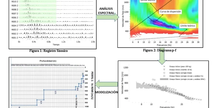
Method and coverage
Regional considerations
Saanich sits in a moderate-to-high seismic hazard zone: the NBCC 2020 assigns a PGA of 0.35g on firm ground for the 2% in 50-year hazard. But site amplification can push that well past 0.50g on soft soils. The silty clays of the Cowichan Head Formation, exposed in low-lying areas near Swan Lake and the Colquitz watershed, exhibit VS30 values in the 150–220 m/s range — firmly Site Class E. Under amplified shaking, these deposits are prone to cyclic softening and post-earthquake settlement. We have measured differential settlement exceeding 75 mm between Site Class E and adjacent Site Class C till under the same design spectrum. For deep excavations in these soils, retaining wall designs require site-specific response spectra that account for impedance contrasts at the till-silt interface. The MASW survey identifies that contrast depth precisely, so the structural engineer can model base shear amplification rather than relying on conservative default factors that inflate foundation costs.
Standards that apply
NBCC 2020 (National Building Code of Canada, seismic provisions Part 4), ASTM D5777-18 (Standard Guide for Using the Seismic Refraction Method — applies to surface wave component), NEHRP Recommended Seismic Provisions for New Buildings (site classification), BC Building Code 2024 (adopts NBCC with provincial amendments), ASCE 7-22 Chapter 20 (Site Classification Procedure, referenced for international projects)
Complementary services
VS30 Site Classification Survey
Active-source MASW with 24-channel array, processed to deliver VS30 and NEHRP/NBCC site class. Includes a signed geophysical report suitable for building permit submission to the District of Saanich and structural engineer's use.
Deep Passive-Microtremor Profiling
Combined active and passive array recording using ambient noise — resolves VS structure to depths beyond 100 m where thick glacial sediments overlie metamorphic basement. Recommended for buildings taller than 4 storeys and essential facilities.
Liquefaction Screening by VS
VS-based liquefaction triggering analysis following Andrus & Stokoe methodology. Paired with CPT or SPT data where available. Delivers factor of safety profiles and post-liquefaction settlement estimates for shoreline and lowland sites.
Typical parameters
Quick answers
How long does a MASW survey take on a typical Saanich residential lot?
On a standard 0.2-hectare residential property in Saanich, an active-source MASW line with 24 geophones takes about 90 minutes of field time. The crew arrives, lays the spread, fires three to five shot stacks per source position, and packs up. Processing and reporting add another two to three business days. If the site requires passive microtremor recording — typical where bedrock is deeper than 30 meters — we leave a 12-geophone array recording for 20 to 30 minutes. Total field time then extends to roughly two and a half hours.
What does a MASW survey cost in the Saanich area?
For a single-line active-source MASW survey on a residential or light commercial lot in Saanich, budget between CA$2,370 and CA$3,720 depending on access conditions, line length, and whether passive recording is required. Sites with limited line-of-sight — steep slopes, heavy tree cover — may require additional setup time and fall at the upper end of that range. The price includes field acquisition, dispersion analysis, VS30 computation, site classification, and a signed geophysical report.
Can MASW replace boreholes for seismic site classification?
Under NBCC 2020, VS30 can be measured by direct geophysical methods — MASW qualifies. The code does not mandate boreholes for site class determination. However, boreholes provide complementary information: stratigraphy, groundwater level, and soil samples for laboratory testing. The most solid approach for larger Saanich projects combines one or two boreholes for ground-truthing with several MASW lines to map lateral variability. That combination nearly always produces a more defensible site class than boreholes or geophysics alone.
How does the local geology affect MASW data quality?
The Vashon till cap — dense, overconsolidated, with shear wave velocities above 400 m/s — creates a high-impedance contrast with underlying glaciomarine silts. This contrast generates a strong, easily interpretable Rayleigh wave dispersion curve. The challenge comes where fill or organic soil overlies the till: the low-velocity surface layer can mask deeper dispersion modes. In those cases, we shift to a passive-source array and record longer wavelengths from ambient noise, which resolves the deeper velocity structure without interference from the near-surface waveguide effect.
Does the District of Saanich accept MASW for building permit geotechnical requirements?
Yes. The District of Saanich building department accepts MASW-derived VS30 and site class reports prepared by a qualified geotechnical engineer or geophysicist, provided the test method follows ASTM D5777 and the report references NBCC 2020 site classification tables. We include a statement of qualifications, equipment calibration records, and the processed dispersion curves in every deliverable. For Part 9 residential construction, a MASW report often satisfies the seismic site classification component without requiring intrusive drilling.